Find out more
Contact Barwon Coast at the following

26 October 2026
Two nests have failed and two remain along our coastline.
26 October 2026
Expressions of interest are now open for temporary summer food vendor permits across Barwon Coast Caravan Parks from 19 December 2026 to 31 January 2027.
15 October 2026
Great news for Hooded Plovers, with two new nests identified at Thirteenth Beach
13 October 2026
Filming for a car commercial is taking place in Barwon Heads on Wednesday 14 October.
7 October 2026
Hooded Plover breeding season is underway across our coast, with a new nest now confirmed.
Published on 18 February 2026
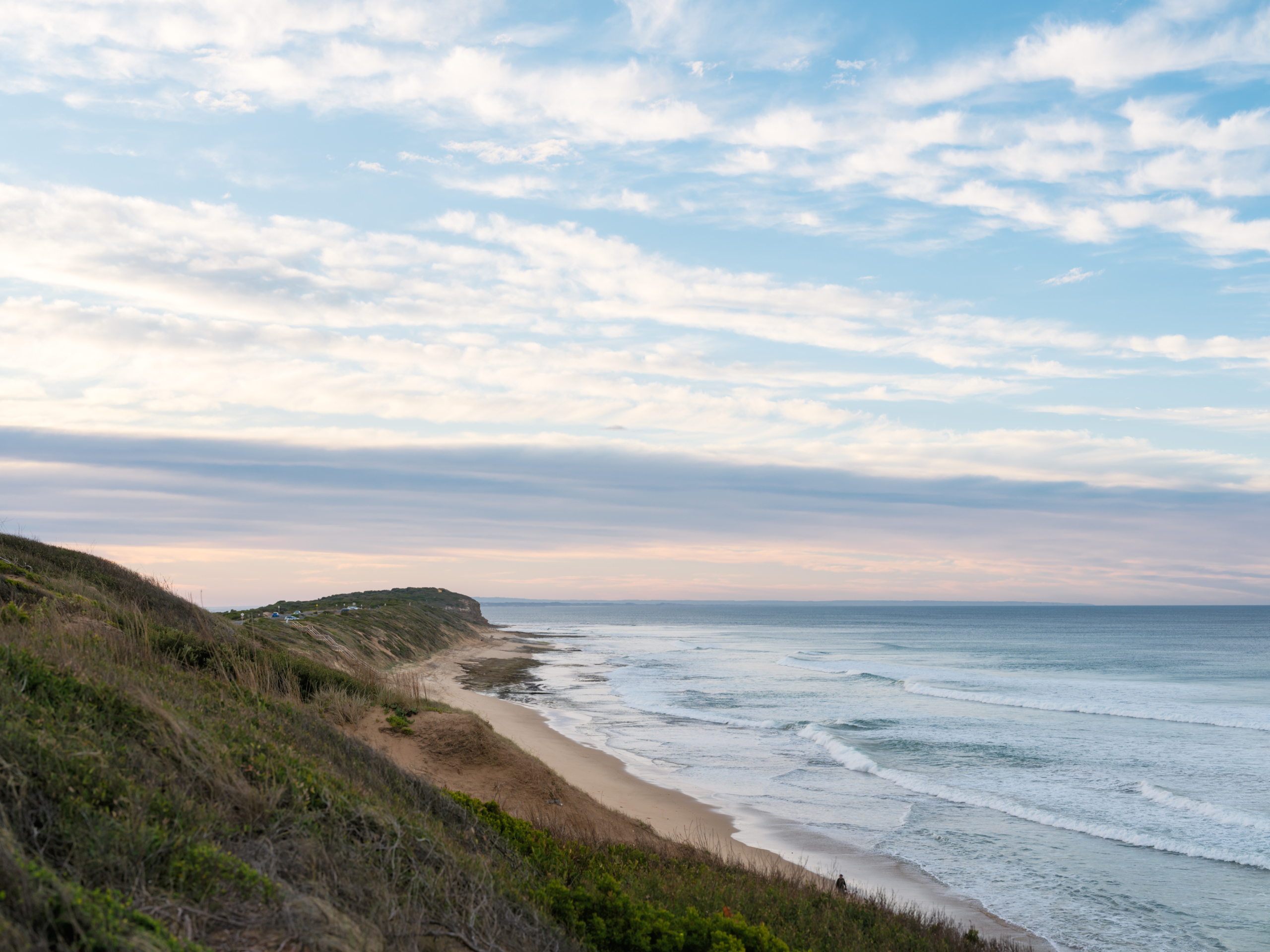
The coast is dynamic and always changing, shaped by natural coastal processes such as erosion and inundation, and at times, natural processes may impact on coastal values and uses. When this occurs, we refer to the processes as ‘coastal hazards’.
Coastal hazard exposure is expected to increase with changes in wave action, storm activity and sea level rise associated with climate change.
Barwon Coast is releasing the Coastal Hazards Exposure Report for the land it manages. The report uses the best available science and local knowledge to refine our understanding of coastal hazard risks, informing safer, more resilient future planning, particularly our Foreshore Master Plan.
The Foreshore Master Plan community engagement found Foreshore that ecological fragility, dune care, and habitat restoration are the strongest community priorities (see the Community Engagement Report here).
Coastal hazards are one of many natural hazards that can occur in areas we enjoy living in and visiting (e.g. bushfire, river flooding, air quality). Improved assessment and mapping of hazards enables us to create a plan to reduce the potential risks and adapt.
We have a responsibility to consider their risk exposure, and act in accordance with the Marine and Coastal Policy 2020.
We are taking a partnership approach to managing coastal hazard risk and proactively adapt, both now and in the long-term. Our approach is following the direction of the Marine and Coastal Policy 2020 and Victoria’s Resilient Coast – Adapting for 2100+ framework and guidelines.
This project increases our understanding of coastal hazard exposure for the coastline we manage, starting with helping shape the actions in the Foreshore Master Plan.
The coastal hazards being assessed in the Coastal Hazard Exposure Report are coastal erosion and coastal inundation on Barwon Coast-managed land.
This report, along with community input and other plans, audits, and strategies, will help inform and shape the actions and directions included in the Foreshore Master Plan, as well as the Coastal Marine Management Plan (CMMP) and other future planning undertaken by Barwon Coast.
We invite the community and visitors to view the Barwon Coast Foreshore Coastal Hazard Exposure report to understand potential future impacts of erosion and inundation along the foreshore.
Read the Coastal Hazard Exposure Report
On Thursday 5 March we held an Online Information Session about the Coastal Hazards Exposure Report.
The expert team who worked with Barwon Coast to create the Coastal Hazards Exposure Report, Water Technology, provided an overview of the report and address key frequently asked questions.
The Victorian Department of Energy, Environment and Climate Action (DEECA) has led the development of ‘Victoria’s Resilient Coast – Adapting for 2100+’ – a strategic approach for coastal hazard risk management and adaptation.
‘Victoria’s Resilient Coast – Adapting for 2100+’ provides a framework, guidelines, and support for Local Government, land managers and their communities to:
In building on the Policy directions, Victoria’s Resilient Coast provides a staged approach to the technical, strategic and engagement elements of risk management and adaptation.
This report is already shaping the actions in the draft Foreshore Master Plan, which will guide the protection, enhancement, and connection of key areas over a 15-year period.
The Foreshore Master Plan will be shared with the community for feedback in early 2026, and we encourage all community members to review the Foreshore Master Plan and share their thoughts. The final Master Plan is expected to be released mid-2026.
To stay up to date on opportunities to have your say on the Draft Foreshore Master Plan, please click the link below.
Keep me up to date with the Foreshore Master Plan
The Coastal Hazards Exposure Report uses the best available science and local knowledge to refine our understanding of coastal hazard risks, informing safer, more resilient future planning.
The majority of the Coastal hazard information included in the Report is currently publicly available at the regional, state and national scale to assist communities and land managers with proactive planning.
This includes inundation and sea level rise scenarios through the City of Greater Geelong’s ‘Our Coast’ study, Coastal Risk Australia, and Victorian assessments through CoastKit (marineandcoasts.vic.gov.au).
The technical assessments completed for this project will assist to refine our understanding of coastal hazard exposure for our local area and inform the Foreshore Master Plan.
No, this report only covers coastal foreshore areas managed by Barwon Coast, extending from Breamlea/Bancoora in the west, to the Collendina Bonnyvale Road beach access to the east.
We work with the following land managers and authorities – if the area you’d like to know more about is managed by another organisation, please contact them for further information:
This project helps manage the coast by providing a clear understanding of areas exposed to erosion and inundation, which informs long-term planning and decision-making. The Coastal Hazard Exposure report identifies risks to foreshore land and infrastructure, helping Barwon Coast and partners plan for adaptation, maintain key assets, and engage the community about future coastal management.
Natural coastal processes like wind, waves, tides and currents work to shift sediment and shape the coastline. When these processes negatively impact on use of the coast, they become coastal hazards. These impacts could be environmental, social, cultural or economic impacts. Coastal hazards include coastal erosion and inundation.
Coastal hazards for the coastal foreshore areas managed by Barwon Coast at Breamlea/Bancoora Beach (between Black Rock and Thompson Creek) presented in this study were developed as part of the Bancoora Coastal Adaptation Plan (‘BCAP’) project. The BCAP project covers Stages 1-5 of Victoria Resilient Coast: Adapting for 2100+ which is being delivered separately by Alluvium Consulting.
The results from Stage 3 Coastal Hazard Exposure of the BCAP project have been integrated into the mapping of this study to provide a consistent set of hazard layers across the management area.
The BCAP project then goes further and builds on this coastal hazard information to assess risk (Stage 4) and develop adaptation pathways (Stage 5).
Under the Marine and Coastal Policy 2020, Committees of Management are required to manage the coast to protect and enhance the coastal values for future generations. This includes considering appropriate coastal use and adaptation in response to coastal hazards. To successfully implement coastal planning, Barwon Coast requires mapping of existing and future coastal hazards as this information is vital for adaptation planning.
Water Technology was commissioned to provide Barwon Coast with existing and future coastal hazard mapping from Breamlea to Collendina to help inform Barwon Coast’s long-term strategic goals.
🖤💛 Have you heard the call of a Yellow-tailed Black-Cockatoo?
You might hear them before you see them! With their distinctive, drawn-out calls, striking yellow cheek patches and bright yellow tail feathers, Yellow-tailed Black-Cockatoos are a spectacular sight in our coastal skies.
These beautiful birds are found across south-eastern Australia, including here on the Bellarine Peninsula.
🌿 Did you know?
Yellow-tailed Black-Cockatoos love feeding on seeds from banksias, hakeas and she-oaks. They`re also known to tear apart pine cones in search of a tasty meal!
They rely on large hollows in mature trees for nesting, making the protection of native vegetation and old trees incredibly important.
Sadly, habitat loss has contributed to declines in their populations, reminding us why caring for our natural environments matters.
Next time you`re out enjoying our coast, keep your eyes to the skies and your ears open!
Learn more from our friends at @birdlifeoz via their website.

H5 bird flu has been detected in some Victorian wetlands.
Boating and fishing can continue as normal in most areas.
If there has been a recent mortality event, avoid activities that could expose you to contaminated water, including swimming, wading, fishing and boating.
✅ Avoid direct contact with sick or dead birds
✅ Wash your hands thoroughly after visiting areas where wild birds gather
✅ Supervise children and pets around affected areas
For more information, visit agriculture.vic.gov.au/birdflu
🥚 A little egg-citing news from Ocean Grove!
A new Hooded Plover nest has been reported along Ocean Grove Beach, between Wedge Street and Tuckfield Street! 🐣
These tiny shorebirds nest directly on the sand, making their eggs incredibly vulnerable to disturbance.
If you`re heading to the beach, please give our little beach-nesting locals the best chance of success by keeping your distance, following signage and keeping dogs away from nesting.
A huge congratulations to Breamlea Coastcare! 🌿🏆
We`re incredibly proud to celebrate Breamlea Coastcare being named Coastcare Group of the Year at the 2026 Victorian Coastcare Awards! 🌿🏆
What a fantastic achievement and such well-deserved recognition for a group that gives so much to protecting and caring for our beautiful coastline.
Much of the hard work that goes into coastal conservation happens quietly behind the scenes, but the difference it makes is enormous, with benefits that will be felt for generations to come.
To everyone involved with Breamlea Coastcare, a heartfelt congratulations and an even bigger thank you! Your passion, commitment and countless hours of volunteering make a lasting difference to our coastal environment and the wider community. 💚
🐦 Don`t forget – the Aussie Bird Count starts today!
Our friends at @birdlifeoz are calling on everyone to spend just 20 minutes counting the birds around them between now and Sunday 25 October.
Whether you`re walking along our beautiful coastline, exploring a local park or relaxing in your backyard, it`s a great way to connect with nature and contribute to important citizen science. 🌿
No experience needed – just download the free Aussie Bird Count app and get counting!
👉 Register at https://aussiebirdcount.org.au
We`re Hiring! Sustainability & Community Officer
Help shape a more sustainable future for our coast and community!
Are you passionate about sustainability, connecting people and making a real difference to our coastal environment?
We`re looking for an enthusiastic and proactive Sustainability & Community Officer to join the Barwon Coast team!
This is an exciting opportunity to help drive our sustainability initiatives, strengthen relationships with our incredible volunteers and community groups, and create meaningful environmental education and engagement opportunities.
You`ll be part of a passionate team dedicated to protecting and caring for the beautiful coastline across Barwon Heads, Ocean Grove and beyond.
Sound like you, or someone you know?
We`d love to hear from you!
👉 Apply now: https://barwoncoast.com.au/career/sustainability-community-officer/
Please share with your networks and help us find our next team member!
#BarwonCoast #Sustainability #CommunityEngagement #EnvironmentalEducation #CoastalConservation #GeelongJobs #BellarinePeninsula
🌿 What does caring for the coast mean?
Well, it means lots of things! From maintaining the facilities and infrastructure across the 22 km of coastal Crown land we manage, to doing everything we can to protect our precious natural environment and restoring native vegetation.
🌱 Like this little Acacia melanoxylon (Blackwood) tree – one of 250 plants of varying native species planted across our coastal reserves over the past three months.
Choosing the right plants for the right places helps restore habitat, support local biodiversity and ensure our coast continues to thrive for generations to come.
It`s all part of the everyday work that goes into caring for our coast. 💚
#CaringForOurCoast #BarwonCoast #CoastalConservation #Biodiversity
🐣🐣 Great news for our little Hoodies!
We`ve got two new Hooded Plover nests at 13th Beach, and the existing nest at Bluff South Dune (The Corner) is still going strong! 💚
🥚🥚🥚 13th Beach – Boings: 3 eggs
🥚 13th Beach – The Ant: 1 egg
🥚🥚🥚 Bluff South Dune – The Corner: Nest still in place!
We`re also keeping a close eye on three potential nesting sites at Bancoora – Black Rock, Breamlea and Wedge Street to Tuckfield Street at Ocean Grove/Collendina.
It`s encouraging news for these vulnerable little shorebirds, but there`s still a long way to go before any chicks successfully fledge.
If you`re heading to the beach, please give our Hoodies plenty of space, follow temporary signage and keep dogs on lead where required.
A huge shout-out to the wonderful Friends of the Hooded Plover – Bellarine volunteers, whose dedication, countless hours of monitoring and tireless efforts to protect these vulnerable little birds make such a difference. We`re so grateful for everything you do to give our Hoodies the best chance of survival! 💚🐣
👉 Read the latest nesting update on our website news page.
🐦 Calling all bird lovers!
The Aussie Bird Count is back from 19–25 October, and our friends at BirdLife Australia (@birdlifeoz) are inviting everyone to get involved!
Whether you`re exploring our beautiful coastline, relaxing in your backyard or visiting a local park, all it takes is 20 minutes to discover the birdlife around you.
It`s a fun, free way to connect with nature while contributing to important citizen science that helps us better understand Australia`s bird populations.
🌿 No birdwatching experience needed – just a keen eye and a little curiosity!
👉 Register now at https://aussiebirdcount.org.au and get counting!
🌱 Our fleet is getting greener! 🚗⚡
We`re making the switch to greener ways of working, with three electric cleaning carts and an electric car already part of our fleet – and an electric van joining us soon!
Even better, our electric fleet is partially powered by renewable energy generated by solar panels installed on some of our facilities. ☀️
It`s all part of our commitment to reducing our environmental footprint and finding more sustainable ways to care for the 22 km of coast we manage.
Small changes making a positive difference for our coast and community. 💚
#BarwonCoast #Sustainability #GreenFleet


This is Wadawurrung Country. We acknowledge the Wadawurrung People as the Traditional Owners of the land, waters, seas and skies of Ocean Grove, Barwon Heads, 13th Beach, Black Rock and Breamlea. We honour and say Nyatne to Elders past, present and future whose ancestors, for thousands of years, have cared for this part of Dja (Country). We are committed as an organisation to meaningfully work together with Traditional Owners to make Wadawurrung Culture and Country strong.
© 2026 Barwon Coast. Website by Residency Studios.